
INTRODUCTION

I am a physical geographer trained in fluvial geomorphology. My research has been involved in hillslope processes (landslide initiation and prediction, rill and gully erosion under overland flows), sediment transport (bed load and suspended sediment load) in river channels and agricultural drainage system, watershed modeling for hydrological and sediment-transport processes, as well as morphological structure of longitudinal profiles of mountain rivers. Since 2015, my research interest has been focusing on two broad areas: (I) River dynamics and environment changes; and (II) Geospatial-based urban studies.
I. River Dynamics and Environment Changes
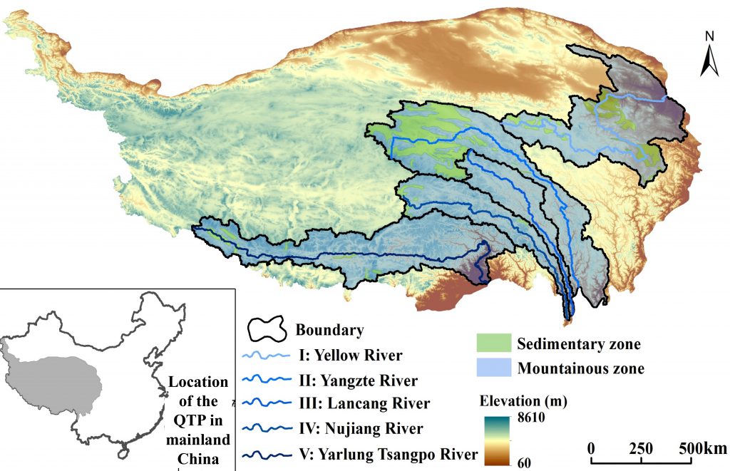
I am interested in understanding physical processes controlling alpine rivers and altering their environments in China’s Qinghai-Tibet Plateau (QTP), which is an important part of ‘the third pole’ of the world. These rivers are distributed in five large watersheds, Upper Yellow River, Upper Yangtze River, Langcang River (upstream of Mekong), Nu River (upstream of Salween), and Yarlung Tsangpo River (see the right figure). Climate change and intensified human disturbance have caused glacier retreat, permafrost degradation, and land cover changes in the QTP, which have imposed great impact on these alpine rivers and their environment. Understanding how they response to these environmental changes will have huge theoretical and practical significance.
My current research scope involves four specific areas:
- Morphodynamic principles dominating braided rivers over multiple spatiotemporal scales.
- Mechanisms controlling evolution of meandering rivers.
- Morphodynamic characteristics of anabranching rivers.
- Interaction between erosion in gullies and channels and groundwater in peatland watersheds.
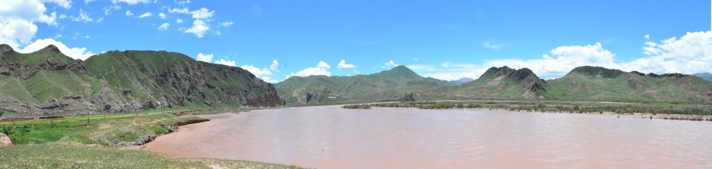
The Upper Lancang River
This type of research typically requires programming ability, modeling capacity, field measurement experience, photogrammetric knowledge, and skills in GIS and Remote Sensing, as well as SfM data processing for UAV data.
II. Geospatial-based urban studies
Urban environments are facing unprecedent challenges due to increase of extreme weather and urbanization. Emerging new technology such as internet, wireless network, and unmanned aerial system (UAS) has catalyzed new demands beyond traditional life styles of city residents. Under this circumstance, I am interested in exploring possible solutions for various management issues relevant to urban ecosystems and their interaction with socioeconomical status of cities through the lens of geospatial techniques such as GIS, RS (Remote Sensing), and unmanned aerial vehicle (UAV).
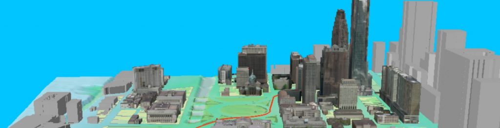
A 3D representation of a proportion of Philadelphia
Examples of projects are
- Flood inundation of extreme storm events and its impact on urban residents.
- Spatial and temporal patterns of snowplow strategy and its socioeconomic significance.
- 3D urban form analysis for UAV mapping services.